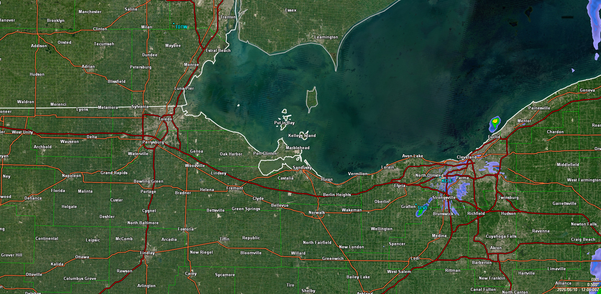
NW Ohio Weather

Lucas, Ottawa, Wood, Sandusky, and Erie counties.

NW Ohio Alerts

NWS Cleveland, OH

Heat Advisory

Area: Lucas; Wood; Ottawa; Sandusky; Erie; Hancock; Seneca

Headline: Heat Advisory issued June 10 at 2:26AM EDT until June 10 at 8:00PM EDT by NWS Cleveland OH

* WHAT...Peak heat index values of around 100 degrees expected.

* WHERE...Erie, Hancock, Lucas, Ottawa, Sandusky, Seneca, and Wood
Counties.

* WHEN...From noon today to 8 PM EDT this evening.

* IMPACTS...Hot temperatures and high humidity may cause heat
illnesses.

Instructions:
Take extra precautions when outside. Wear lightweight and loose
fitting clothing. Try to limit strenuous activities to early morning
or evening. Take action when you see symptoms of heat exhaustion and
heat stroke.

Severity: Moderate   Urgency: Expected   Certainty: Likely   From: 6/10 2:26 AM   Until: 6/10 8:00 PM

US Satellite

GOES 19
US Satellite
NOAA

Area Satellite

Great Lakes
Great Lakes Satellite
NOAA

US Radar

National Radar Loop
US Radar Loop
NWS

Area Radar

Regional Radar loop
Regional Radar Loop
NWS

Local Radar

Current
Local Radar
WZ8H Local Radar

Radar Loop

Local Radar Movie
Local Radar Loop
WZ8H Radar Movie

Lightning

Live Lightning Map
Live Lightning Map

Weather Webcam

Live Cam
Weather webcam
Live Weather Cam

U.S. Warnings

Current map
US Warning Map
weather.gov

Forecast Map

National
National Forecast Map
NOAA

Updated

Server Time
6/10/2026 6:57 AM

NW Ohio Forecast

Regional

Today

Mostly sunny, with a high near 92. Heat index values as high as 100. Southwest wind 9 to 15 mph. New rainfall amounts less than a tenth of an inch possible.

Tonight

A chance of showers and thunderstorms before 8pm, then a chance of showers and thunderstorms between 8pm and 11pm, then a chance of showers and thunderstorms. Mostly cloudy, with a low around 73. Heat index values as high as 99. Southwest wind 10 to 15 mph. Chance of precipitation is 40%. New rainfall amounts between a tenth and quarter of an inch possible.

Thursday

A chance of showers and thunderstorms before 11am. Mostly sunny, with a high near 91. Heat index values as high as 99. Southwest wind around 16 mph. Chance of precipitation is 30%. New rainfall amounts between a tenth and quarter of an inch possible.